Crumplebury, Herefordshire
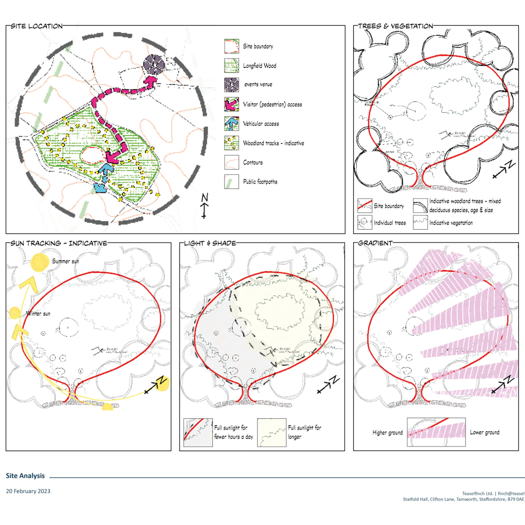
I’ve been working with an estate in Herefordshire to create conceptual plans and image boards for a simple satellite venue to extend their hospitality offerings into a woodland clearing recently created due to removal of trees affected by ash die back.
Ordinarily I would employ a professional site surveyor to map out the site and provide a CAD file, to give accurate measurements, levels and tree and vegetation locations. But, as this is a conceptual exercise to inform a business analysis, we’ve opted for a sketchy approach with indicative positions and layout.
A site analysis considers the exposure (sun, rain, wind, visibilities), topography, ground and soil conditions, views in and out (any to be highlighted, or others to be screened or lessened in impact), opportunities and conflicts, any designations, access, services (water, electricity, pylons, drainage, telecoms, national pipe lines) and any wayleaves and clearance zones that these may require, visual impact, context and more. This will then inform the layout, design and look of all elements of the site, creating something unique to the client and the site.
If you’re developing ideas for a wedding or events venue, holiday accommodation, farm shop or any other rural diversification that needs to look great, or your garden looks tired or no longer works for you, drop me a message and we can chat about how I can help you create that stunning destination you’ve got in mind.

